
Practical Atlas of Tatras
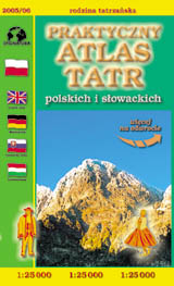
scale
legend
size
1st edition
author
publishers
ISBN
1:25 000
5 languages
11,5 x 18,5 cm, 144 pages
2005
Michael Siwicki
83-87873-85-3
![]()
Dear Reader!
You will find, among others:
![]() detailed maps in 1:25 000 scale,
detailed maps in 1:25 000 scale,
![]() detailed city-maps in 1:15 000
scale,
detailed city-maps in 1:15 000
scale,
![]() comprehensive set of text informations
about the mountains,
comprehensive set of text informations
about the mountains,
![]() index
of thousands of geographical names,
index
of thousands of geographical names,
![]() geographical
grid for GPS
geographical
grid for GPS
)
)
guide to the nature of the region
detailed map
© Zakład Kartograficzny Sygnatura, Wydawnictwo Kartograficzne Polkart